
Shared Journeys
NAMRATA NARENDRA & MEGHA KASHYAP
Shared Journeys
NAMRATA NARENDRA & MEGHA KASHYAP

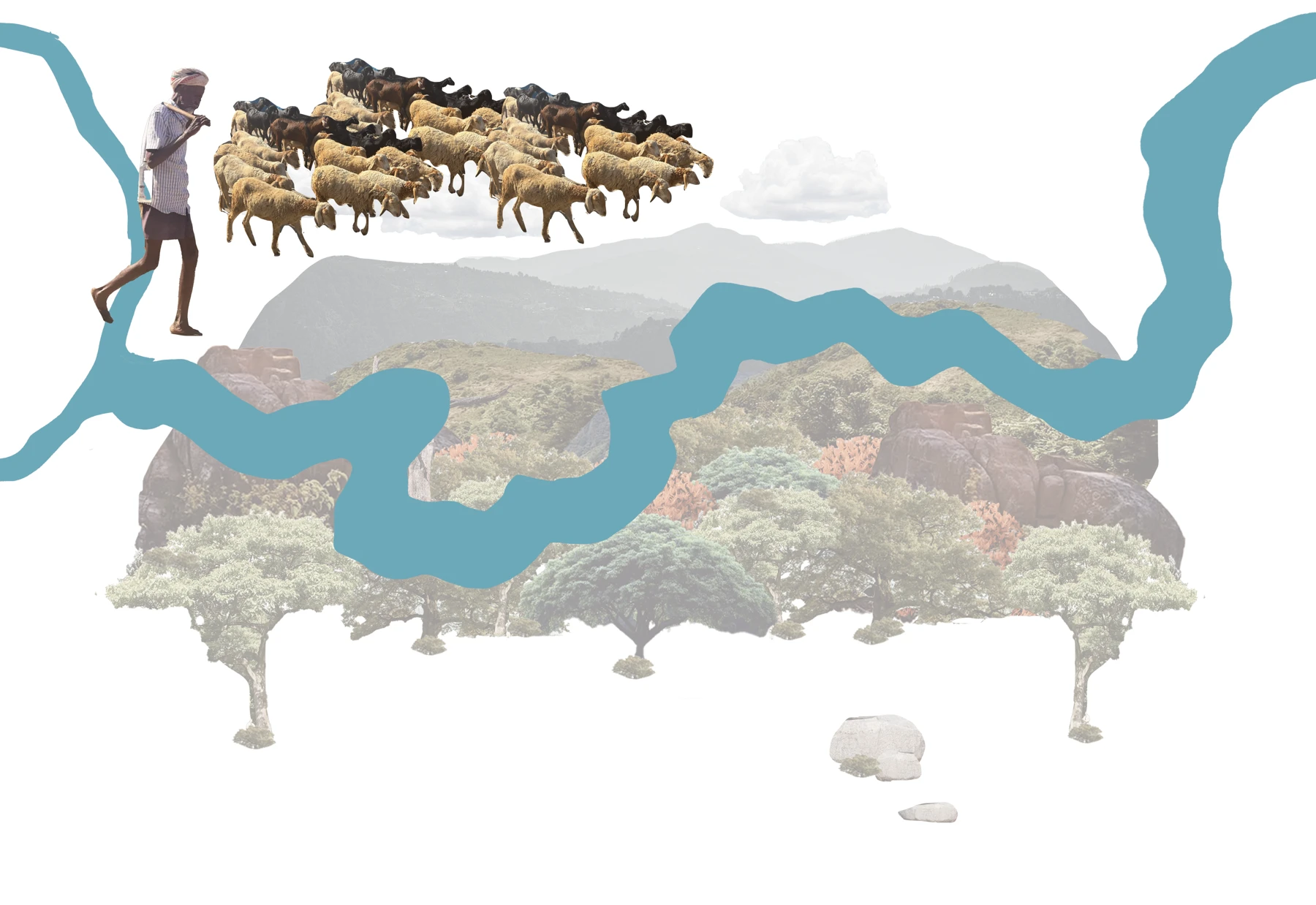
Rivers move us beneath us and beyond.
We are the water we drink in altered forms the sheep drink too closer to the ground
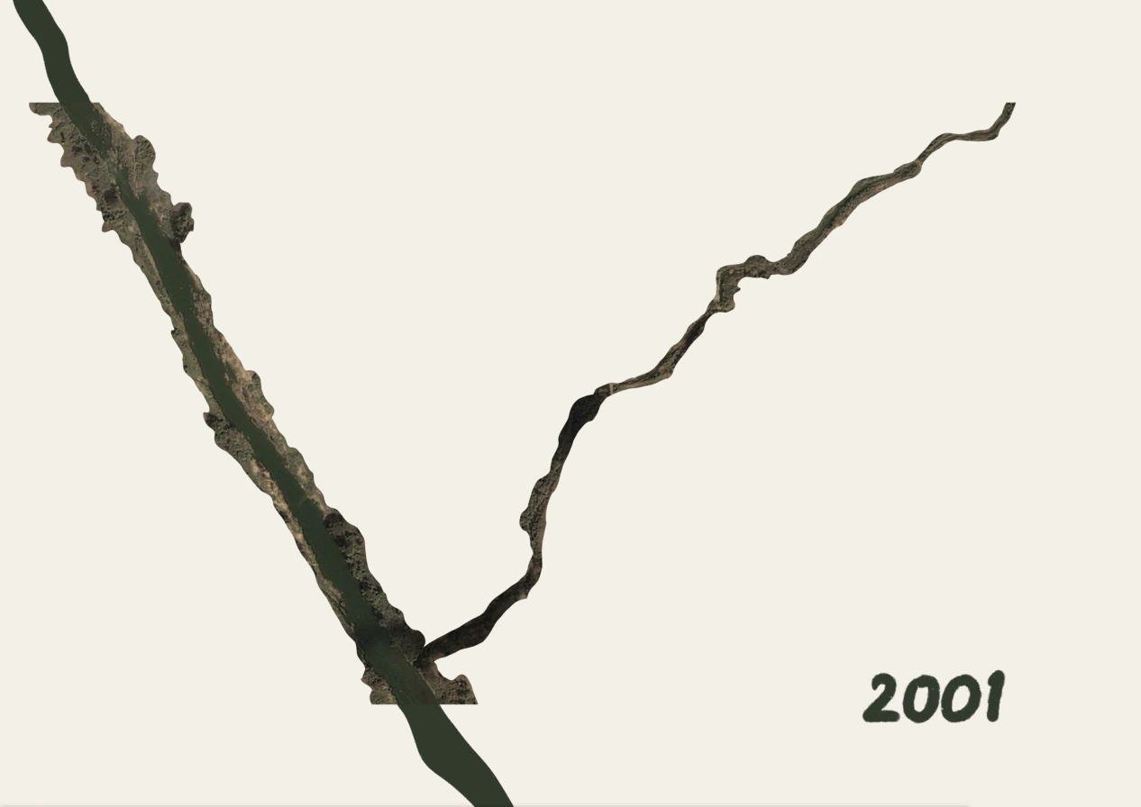
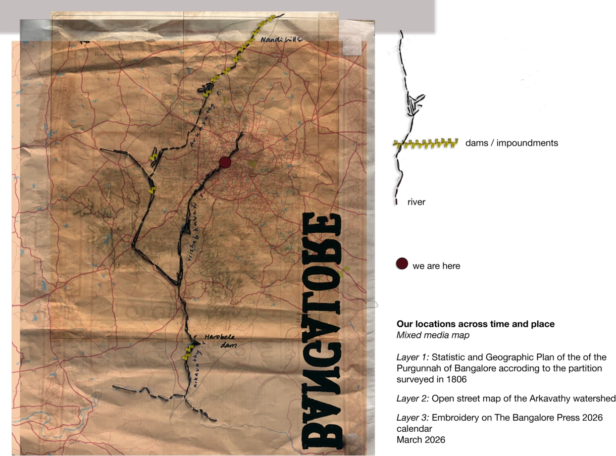
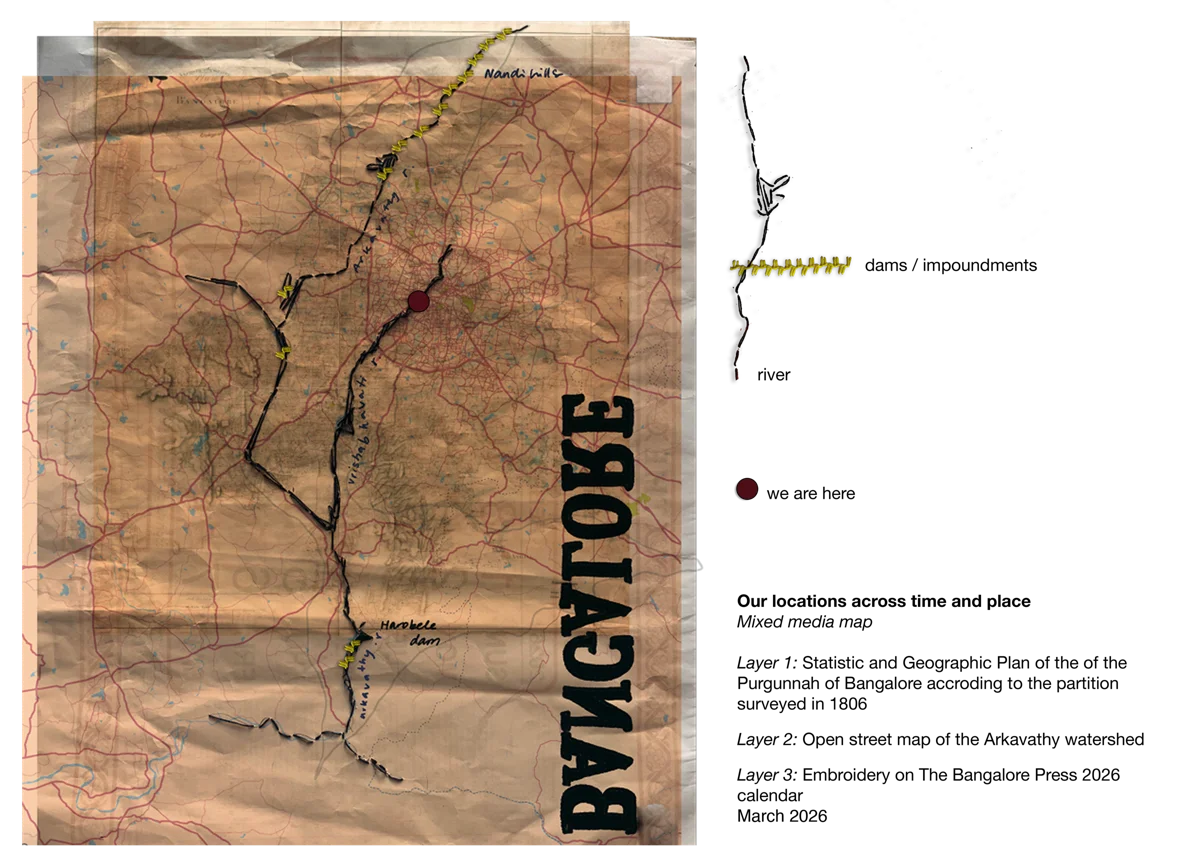
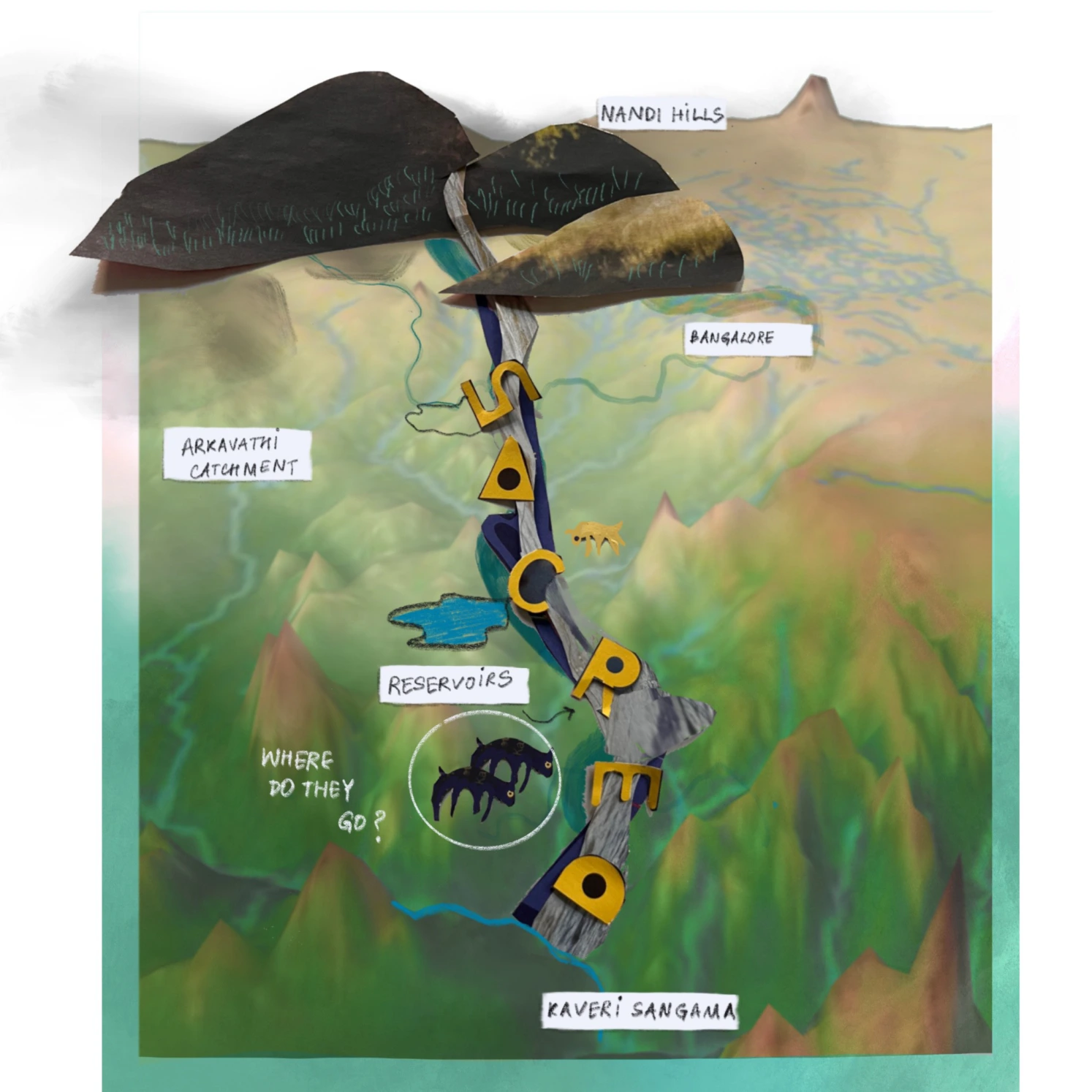
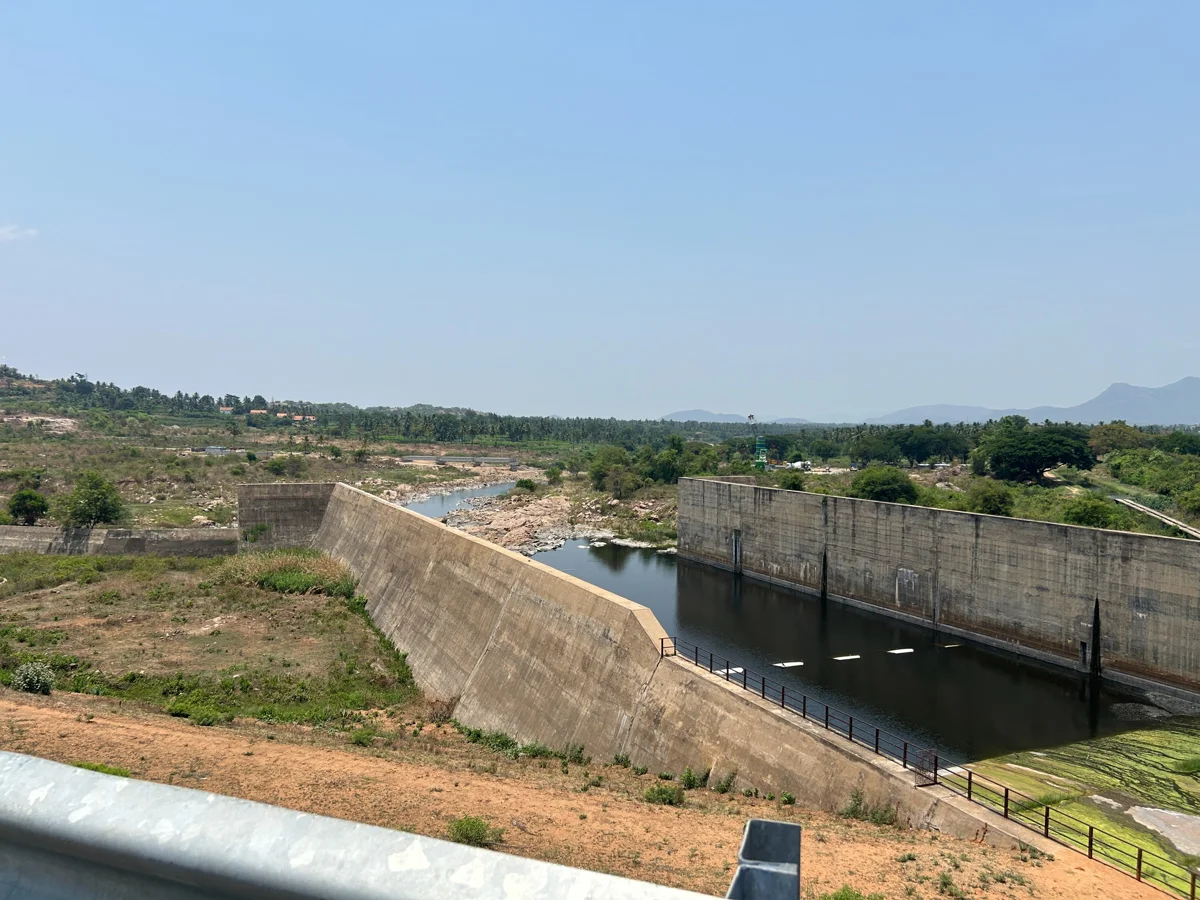
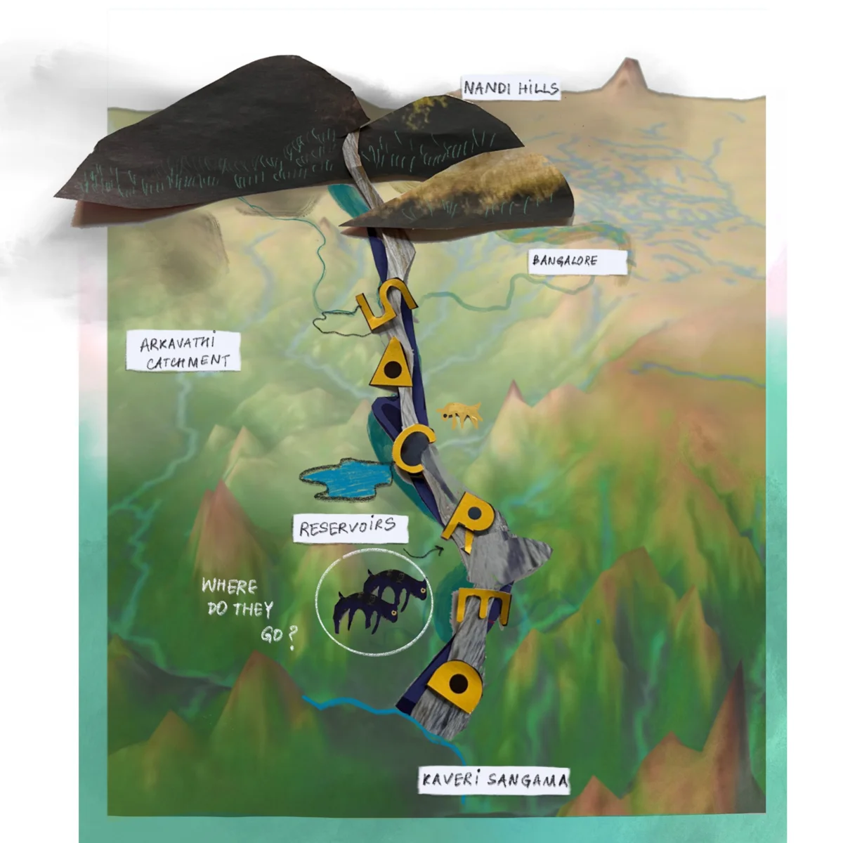
Arkavathi is a mountain river in the Deccan region, a tributary of the river Kaveri, originating in Nandi Hills near Bangalore. The river stretches for nearly 190 km before meeting Kaveri, and is hidden by the urbanising landscape of Bangalore and its peri-urban regions (Magadi, Ramangara, Kanakapura). From its four main reservoirs constructed one after the other to meet the burgeoning water needs of Bangalore city - Hesarghatta, Tippagondanahalli, Chamarajasagar, Harobele or Arkavathi, one can get glimpses of what the river currently looks like.
Walking through the backwaters of the many dams built on Arkavathi (13 to be exact), the landscape and its sounds gives away the tension of the region and what has changed - the sound of vehicles, birds, cattle and theppas break the silence of the ghost villages. Residents moved out because the villages flooded with the construction of the dams.
Arkavathi is a mountain river in the Deccan region, a tributary of the river Kaveri, originating in Nandi Hills near Bangalore. The river stretches for nearly 190 km before meeting Kaveri, and is hidden by the urbanising landscape of Bangalore and its peri-urban regions (Magadi, Ramangara, Kanakapura). From its four main reservoirs constructed one after the other to meet the burgeoning water needs of Bangalore city - Hesarghatta, Tippagondanahalli, Chamarajasagar, Harobele or Arkavathi, one can get glimpses of what the river currently looks like.
Walking through the backwaters of the many dams built on Arkavathi (13 to be exact), the landscape and its sounds gives away the tension of the region and what has changed - the sound of vehicles, birds, cattle and theppas break the silence of the ghost villages. Residents moved out because the villages flooded with the construction of the dams.



Are there pastoralists coming to this region at all? Where do they go with their animals?
And how has the landscape changed over the years?

We began looking at where pastoralists take their animals now, and we found a big gap in the routes beyond Bangalore, especially in the south. There is abundant documentation on pastoralists in the north of the Deccan region and from the north of Bangalore, from areas such as Tumkur, Sira, moving east through Bangalore city or sometimes further south to Mysore and west to Malenadu.
But because of urban expansion, they no longer have the access they did, to the wet landscapes in the dry summer months because in a lot of ways, they have lost access to the city. The gomala (grazing) lands have shrunk significantly in the last 30 years as the city is increasingly being concretised.
We began looking at where pastoralists take their animals now, and we found a big gap in the routes beyond Bangalore, especially in the south. There is abundant documentation on pastoralists in the north of the Deccan region and from the north of Bangalore, from areas such as Tumkur, Sira, moving east through Bangalore city or sometimes further south to Mysore and west to Malenadu.
But because of urban expansion, they no longer have the access they did, to the wet landscapes in the dry summer months because in a lot of ways, they have lost access to the city. The gomala (grazing) lands have shrunk significantly in the last 30 years as the city is increasingly being concretised.
Are there pastoralists coming to this region at all? Where do they go with their animals?
And how has the landscape changed over the years?
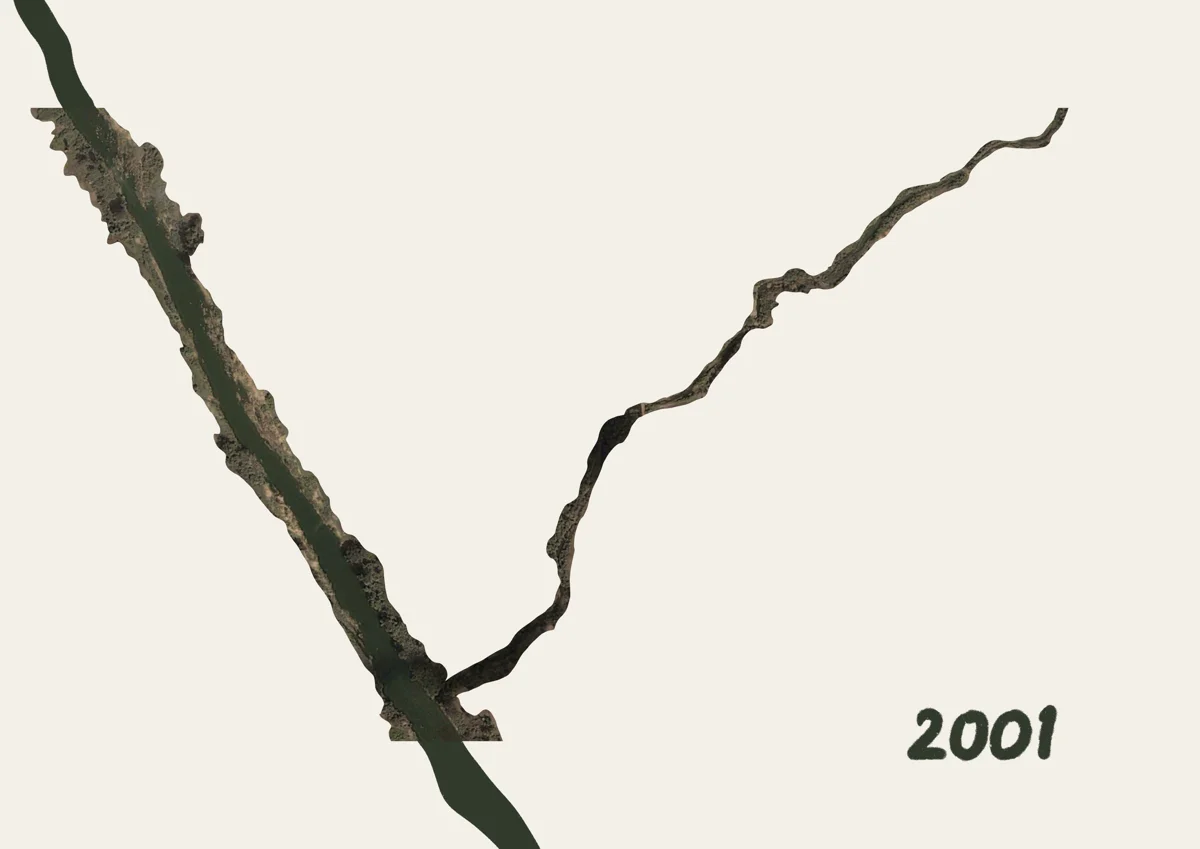


“I have vague memories of the kurubas who came from Tumkur, they used to stay here in our village for a few days. I was a child then, I remember playing with them and their goats. They stopped coming after the dam was built.”
~18 year old man living in Honniganahalli village
Akravathi’s Changing Landscapes
Akravathi’s Changing Landscapes
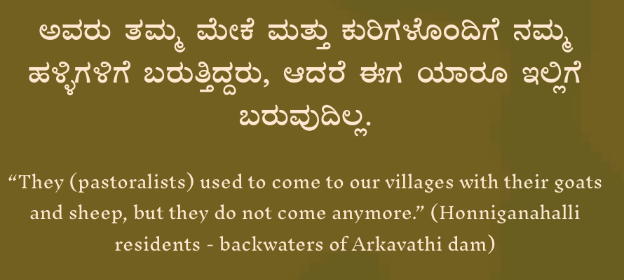
“I have vague memories of the kurubas who came from Tumkur, they used to stay here in our village for a few days. I was a child then, I remember playing with them and their goats. They stopped coming after the dam was built.”
~18 year old man living in Honniganahalli village
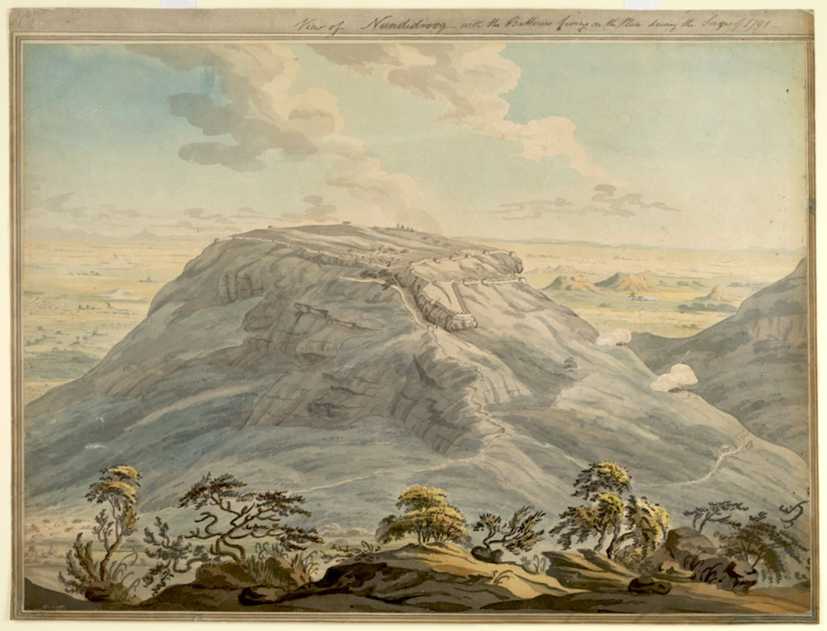
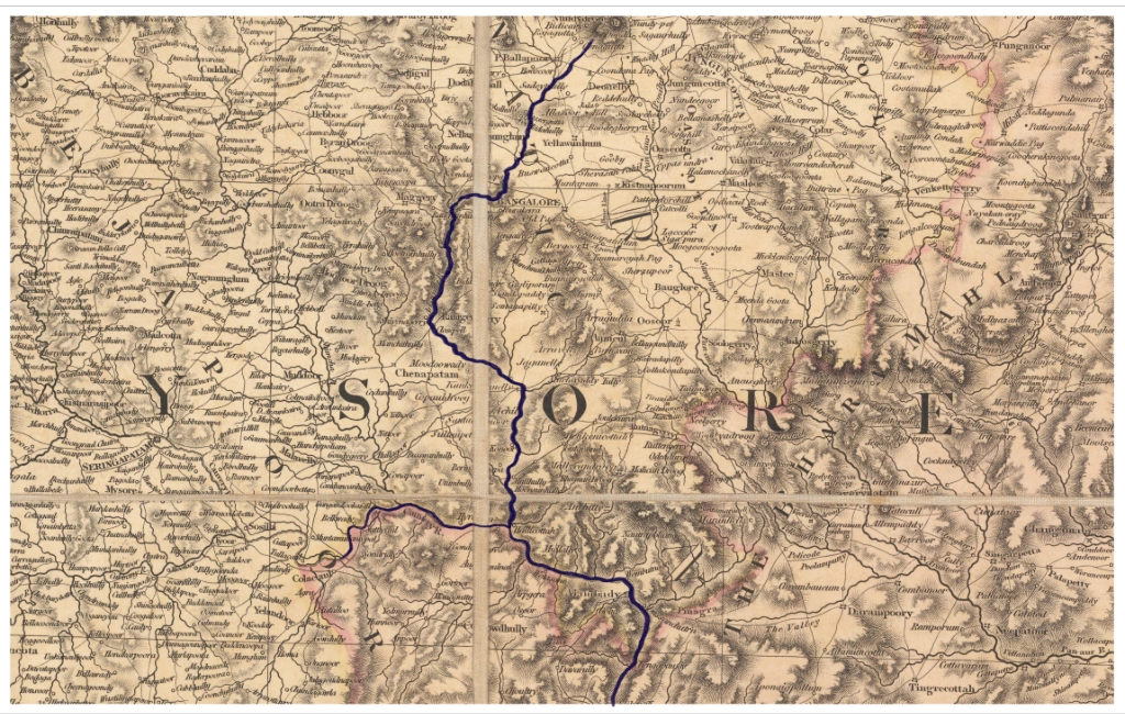
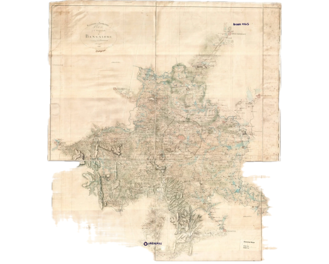
Origin of the Arkavathi river. View of Nandidrug (Nandi Hills fort), with the batteries firing during the siege — 1791
Source: Water-colour painting by Colin MacKenzie (1754–1821)
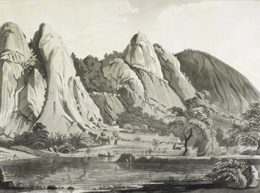
South view of Savandurga, near (present day) T.G Halli reservoir, 1794
Source: Aquatint on paper Copyright © The British Library Board
Arkavathi documented in Aaron Arrowsmith’s improved map of 1821
Arkavathi and Harohalli villages documented on the statistical and geographical plan of the Purgunnah of Bangalore in 1806
Source: National Archives, New Delhi, India


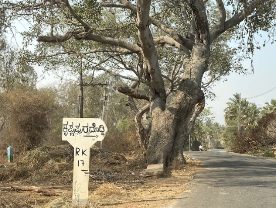
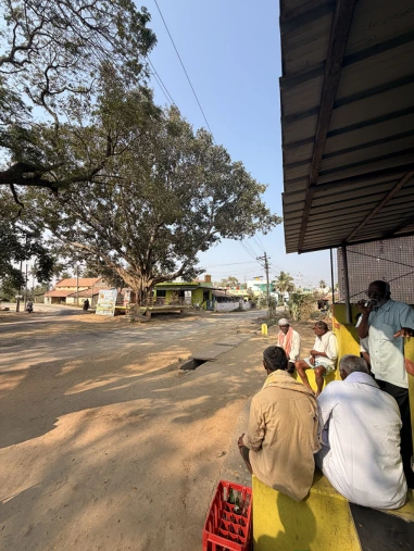
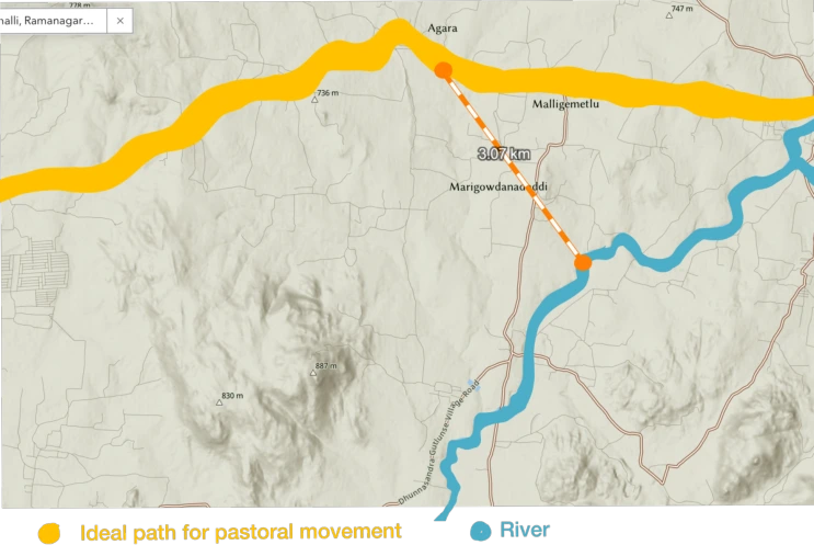
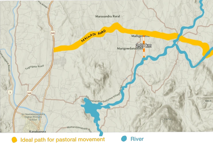

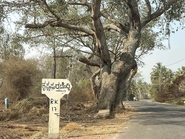
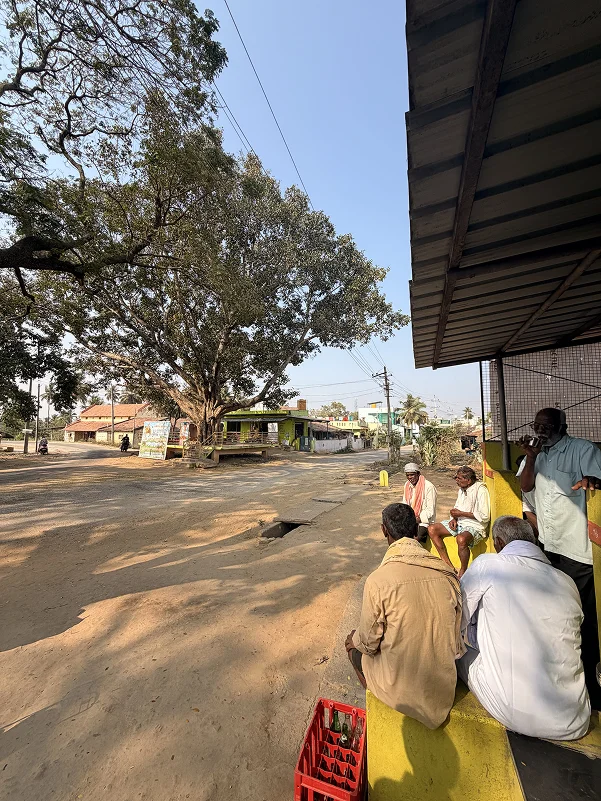
We were tracing the wake of their movement rather than encountering them directly. There were leads everywhere, villagers who had seen them pass through, tea stalls where they
had stopped, farmers who had hosted them briefly. The trail was active, but always just out of reach.
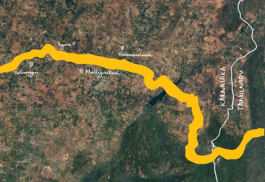
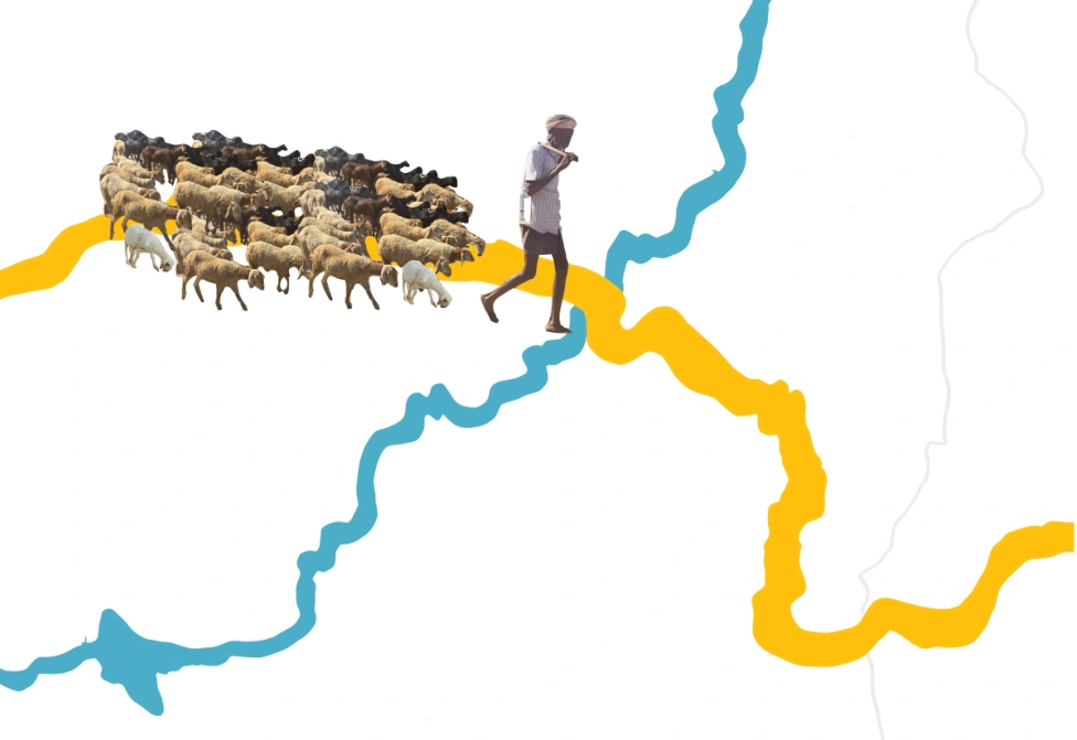
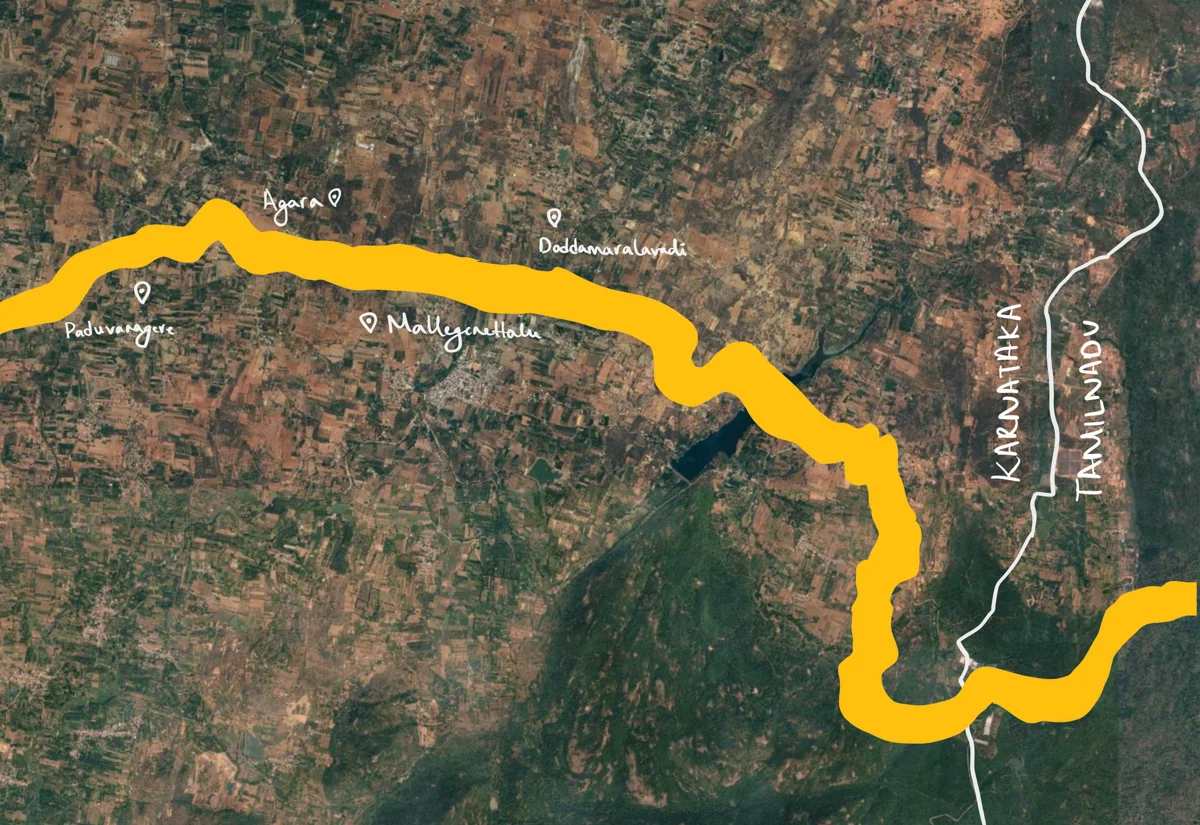
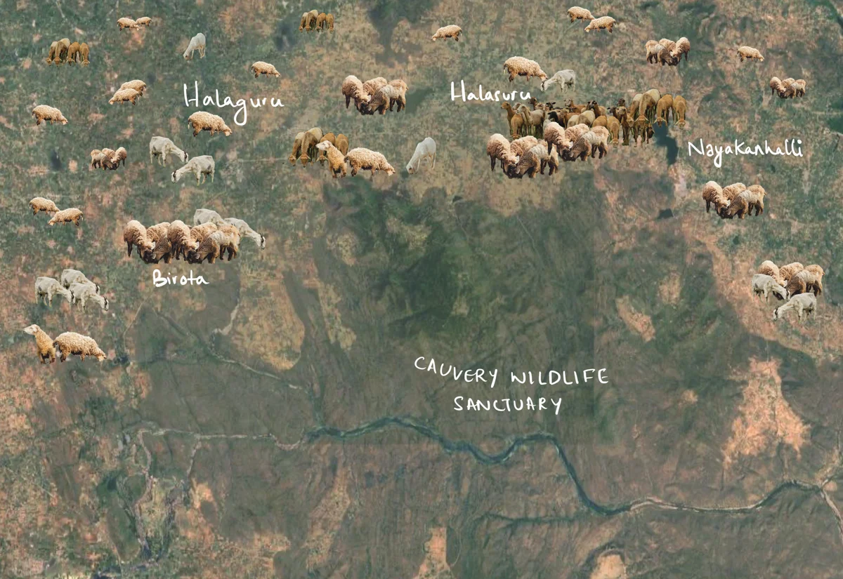
Across villages, a shared understanding emerged. People knew the herders stayed for about fifteen days, travelled with roughly 300 sheep, and moved along a widely recognised route from Tamil Nadu through Karnataka.

Along the mapped route, doddis, temporary pastoral encampments are visible and numerous. Their repeated presence indicates that the landscape continues to accommodate and support pastoral movement.
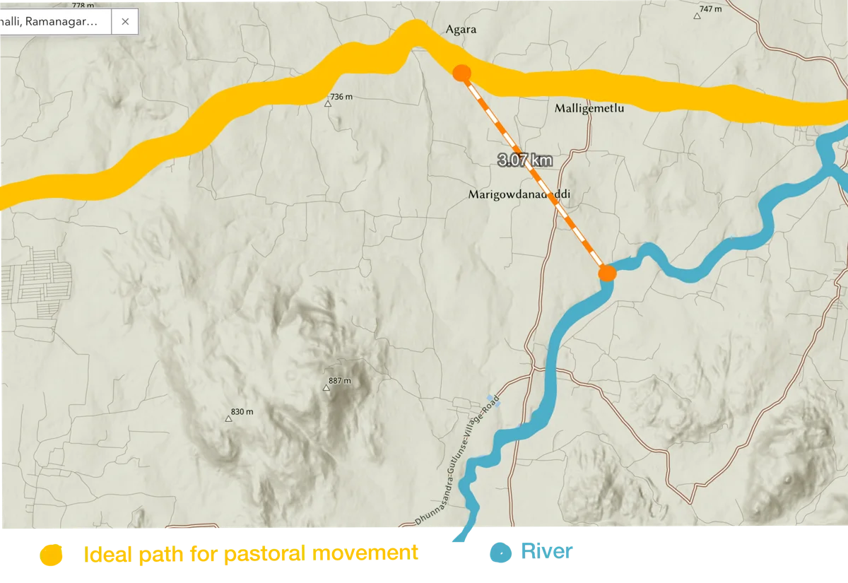
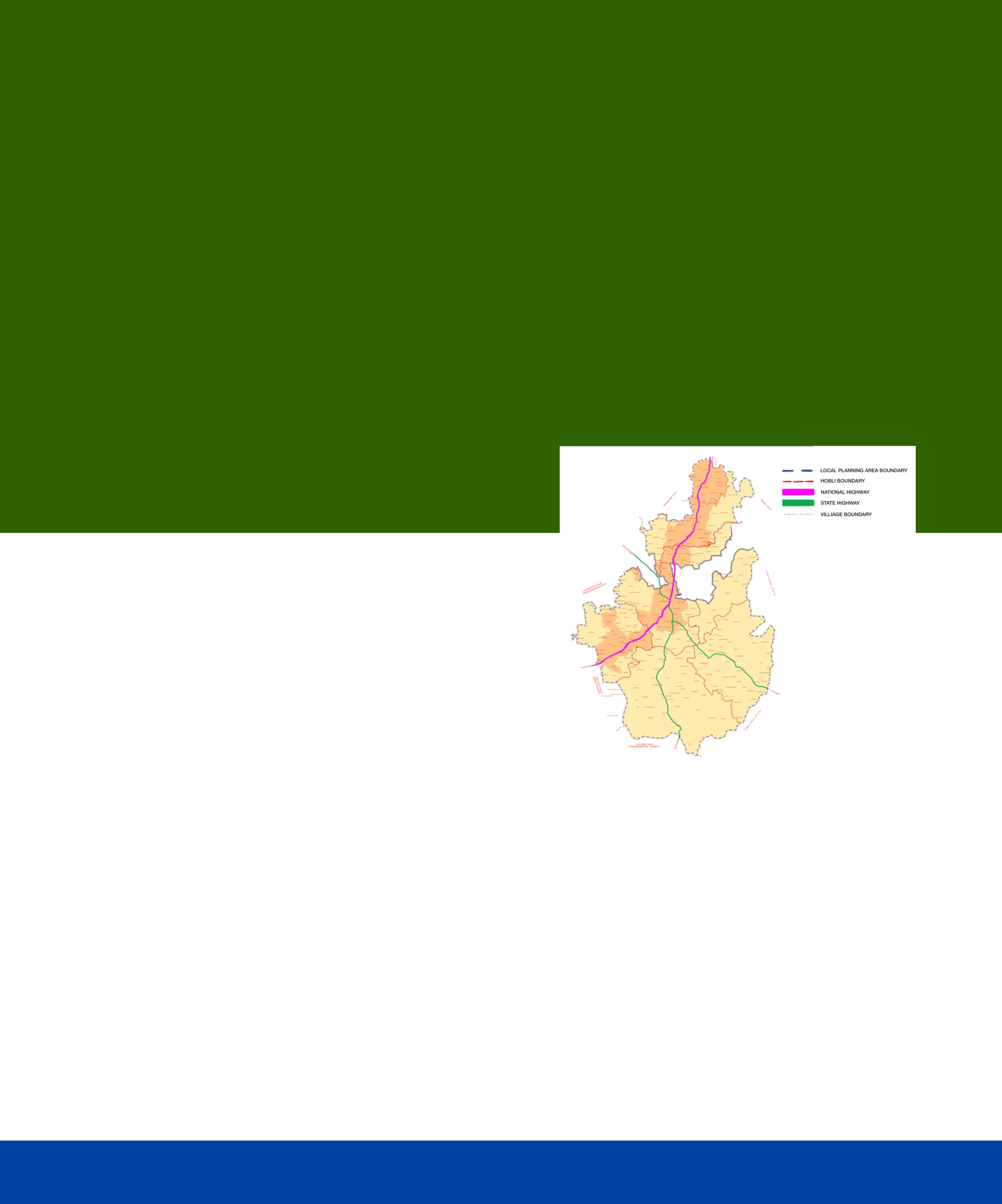
The route itself is not arbitrary. It is deliberately secluded, running away from highways and areas of dense urbanisation. Instead, it follows a rural corridor shaped by agriculture, low settlement density, and proximity to the Kaveri River.
Access to water is fundamental. The route aligns with lakes, seasonal water bodies, and stretches that run adjacent to the river, ensuring that herds can be sustained across long distances.

At Agara, we were told: “They were here. They left maybe a week ago.”

We followed this chain from one settlement to the next. It became a predictable movement:

Is there an ideal route for more-than-human movement?

At Kai Lancha: “Yes, they passed through. Heading south.”

At Malligemetlu: “They stay about 15 days in each village. You just missed them.”

At Doddamaralavadi: “Try the next village. They might be there now.”
Pastoral Journeys & Time
Pastoralists of the Deccan don't usually come south (Insights from conversation between with Mahesh Bhatt and Living Lightly team (2024-2025) . This is mainly because they have been pushed out of the city, but also because of water shortages in the south. After 2000s, there is very little documentation of pastoralist movements in South Karnataka. This is what we want to study.
We set out along the course of the river to speak to pastoralists and understand their journeys in this region.
Pastoral Journeys & Time
Pastoralists of the Deccan don't usually come south (Insights from conversation between with Mahesh Bhatt and Living Lightly team (2024-2025) . This is mainly because they have been pushed out of the city, but also because of water shortages in the south. After 2000s, there is very little documentation of pastoralist movements in South Karnataka. This is what we want to study.
We set out along the course of the river to speak to pastoralists and understand their journeys in this region.
We followed this chain from one settlement to the next. It became a predictable movement:
At Agara, we were told: “They were here. They left maybe a week ago.”
At Kai Lancha: “Yes, they passed through. Heading south.”
At Malligemetlu: “They stay about 15 days in each village. You just missed them.”
Is there an ideal route for more-than-human movement?
At Doddamaralavadi: “Try the next village. They might be there now.”
We were tracing the wake of their movement rather than encountering them directly. There were leads everywhere, villagers who had seen them pass through, tea stalls where they
had stopped, farmers who had hosted them briefly. The trail was active, but always just out of reach.
Across villages, a shared understanding emerged. People knew the herders stayed for about fifteen days, travelled with roughly 300 sheep, and moved along a widely recognised route from Tamil Nadu through Karnataka.
Along the mapped route, doddis, temporary pastoral encampments are visible and numerous. Their repeated presence indicates that the landscape continues to accommodate and support pastoral movement.
The route itself is not arbitrary. It is deliberately secluded, running away from highways and areas of dense urbanisation. Instead, it follows a rural corridor shaped by agriculture, low settlement density, and proximity to the Kaveri River.
Access to water is fundamental. The route aligns with lakes, seasonal water bodies, and stretches that run adjacent to the river, ensuring that herds can be sustained across long distances.
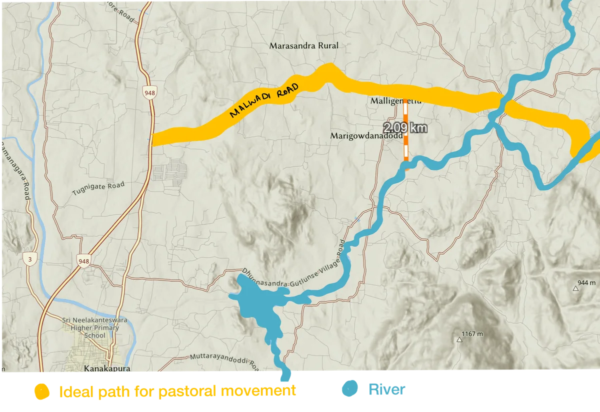


Together, these elements form a distributed infrastructure, one that is not formally designed, but collectively maintained through use. This spatial pattern reveals how pastoral systems navigate contemporary landscapes. The route actively avoids highways, urban sprawl, and industrial zones, not because they lack connectivity, but because they are incompatible with livestock movement.
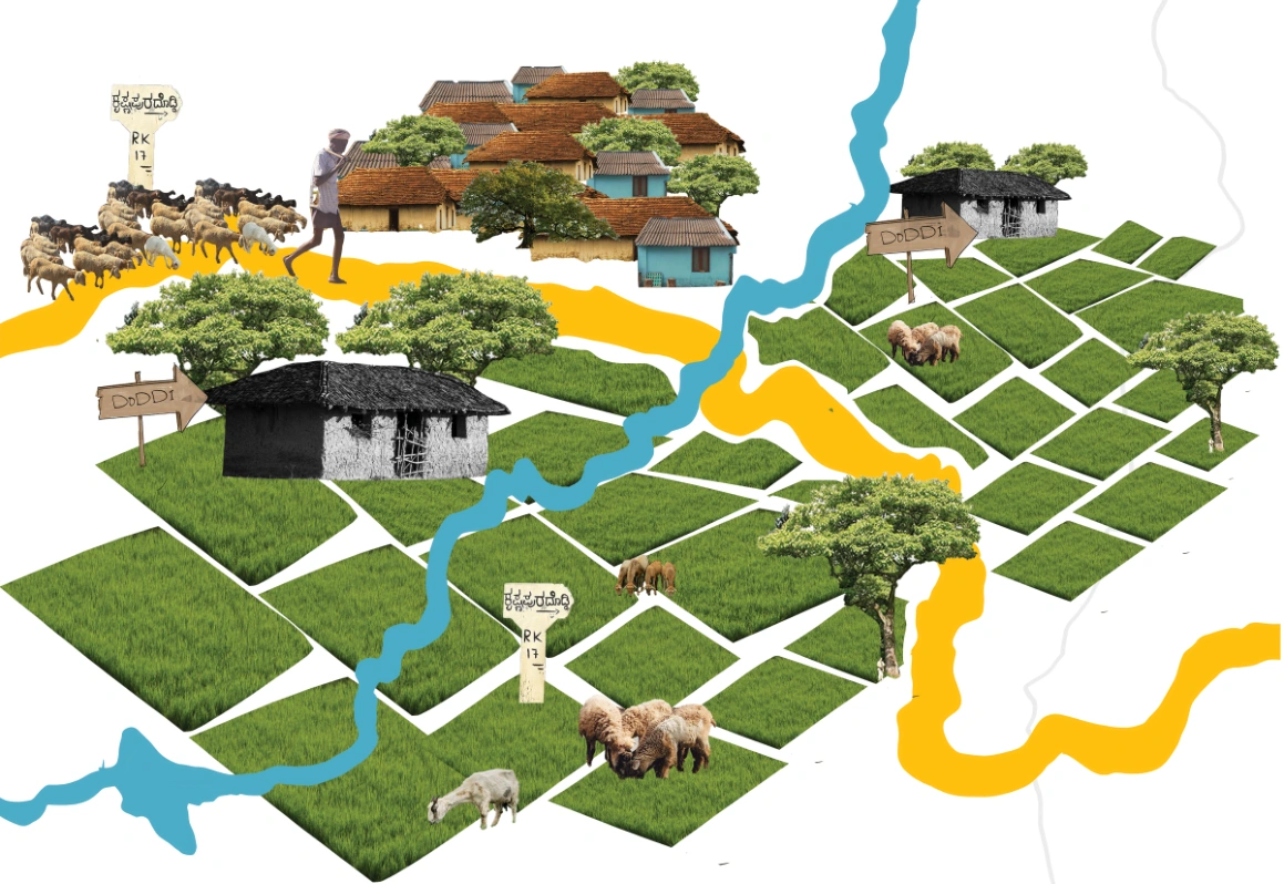
Instead, it follows agricultural land where older relationships still function. Grazing on harvested stubble, exchange with farmers, and temporary settlement in marginal spaces together sustain a system that is both mobile and deeply embedded in the rural landscape.
Physical Pathways
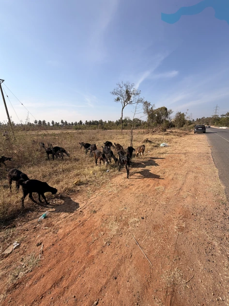
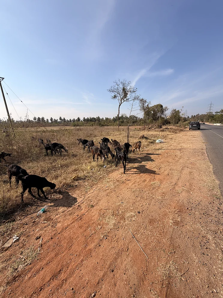
Movement depends on navigable routes, roads, dirt paths, and field edges, that allow large herds to pass without entering private agricultural land or disrupting vehicular traffic. These are not formal corridors, but they are widely understood and used.
Together, these elements form a distributed infrastructure, one that is not formally designed, but collectively maintained through use. This spatial pattern reveals how pastoral systems navigate contemporary landscapes. The route actively avoids highways, urban sprawl, and industrial zones, not because they lack connectivity, but because they are incompatible with livestock movement.
Instead, it follows agricultural land where older relationships still function. Grazing on harvested stubble, exchange with farmers, and temporary settlement in marginal spaces together sustain a system that is both mobile and deeply embedded in the rural landscape.

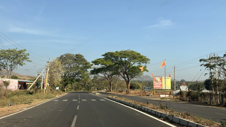
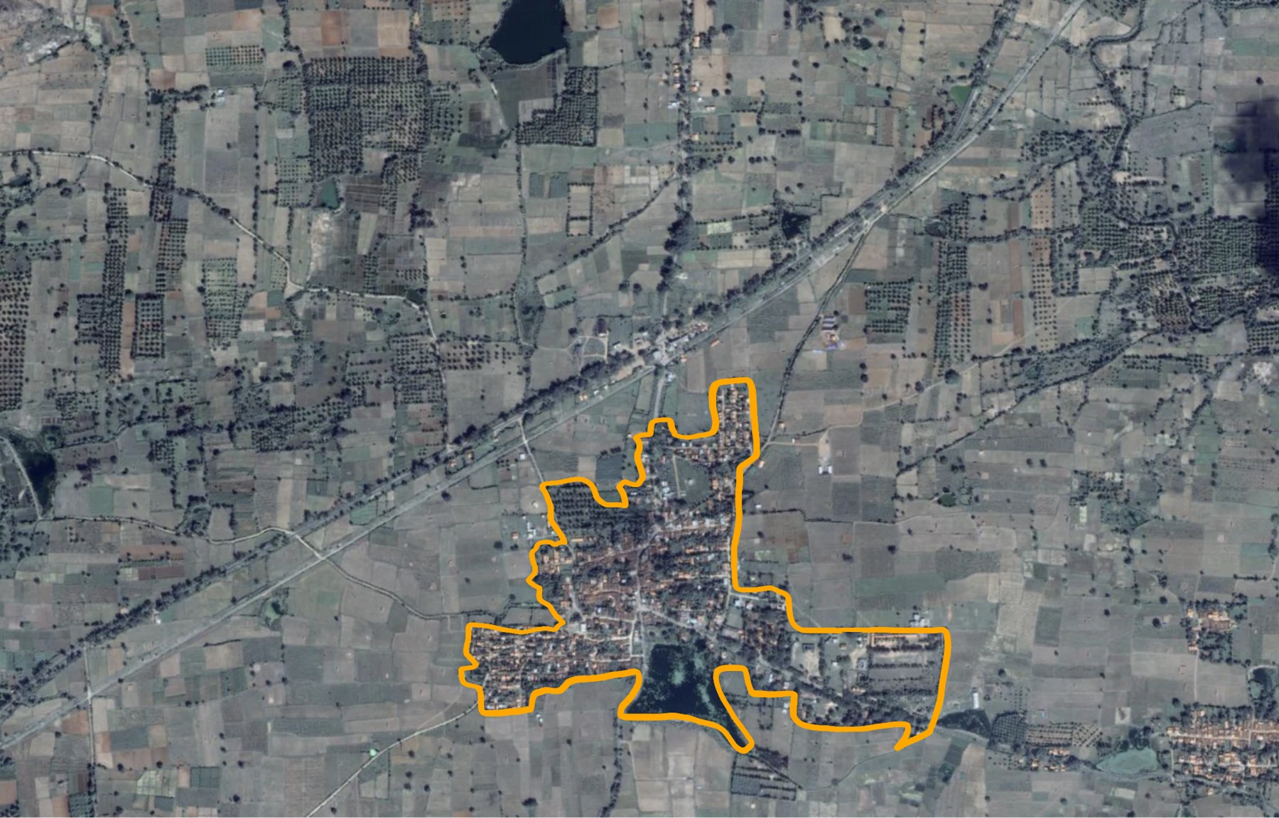
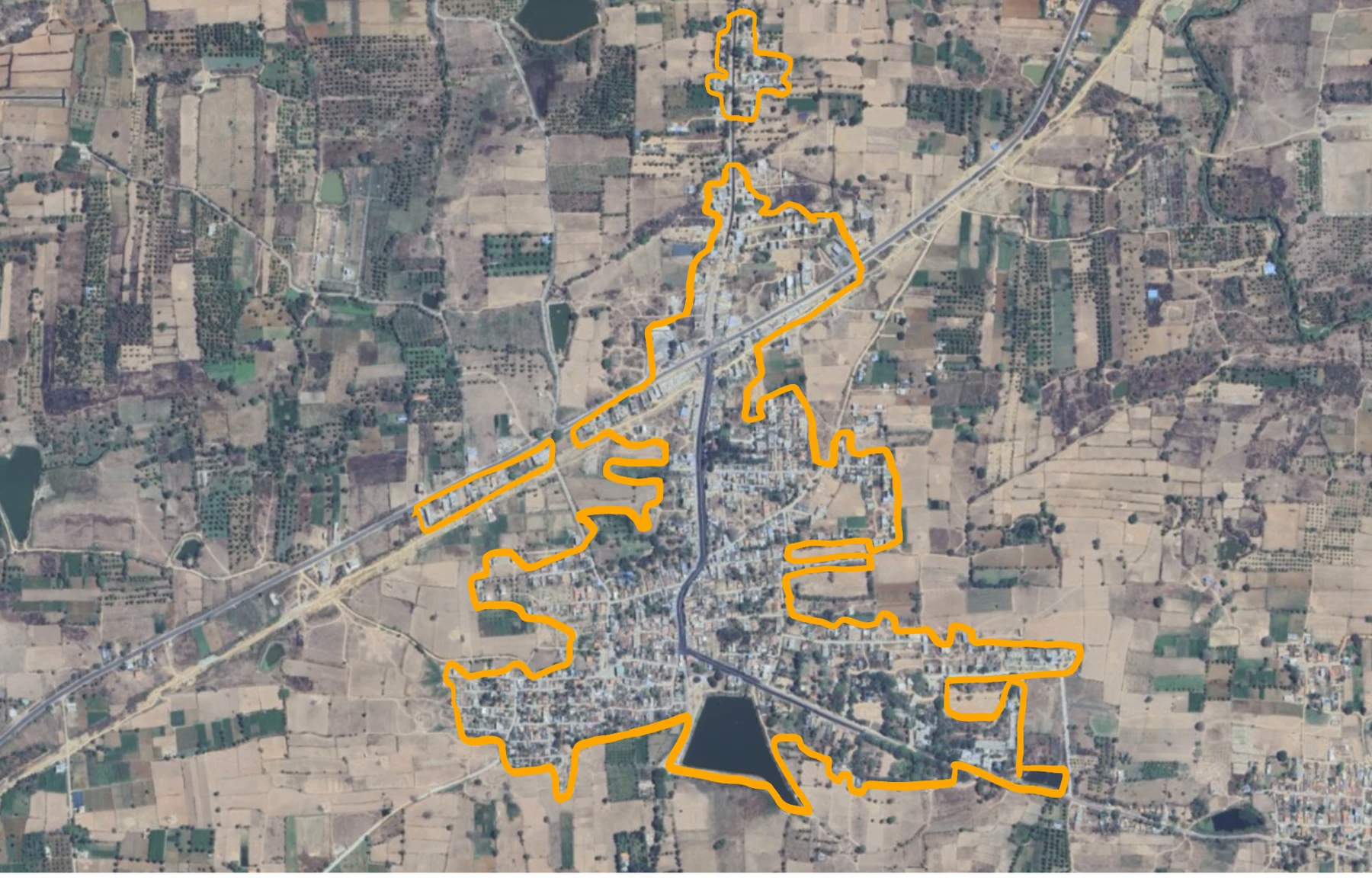
A well-constructed road now cuts through this stretch, with visible signs of highway development along the approach routes. Near the sanctuary edge in Sathanur, infrastructure associated with religious visitation has expanded, parking areas, shelters, and paved pathways structure how people move through the space. The terrain has been levelled and formalised, directing circulation and limiting open, flexible use.
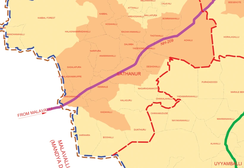
The Due Diligence Required for More-Than-Human Movement
The herd we encountered refused to deviate to Sathnur, despite being offered access to land and resources. This means that these routes are not flexible or opportunistic. They are fixed based on generations of accumulated geographic and social knowledge.
Following that lead, what I encountered was a landscape that had been substantially reorganised.
The Due Diligence Required for More-Than-Human Movement
The herd we encountered refused to deviate to Sathnur, despite being offered access to land and resources. This means that these routes are not flexible or opportunistic. They are fixed based on generations of accumulated geographic and social knowledge.
Following that lead, what I encountered was a landscape that had been substantially reorganised.
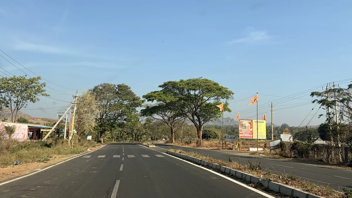
A well-constructed road now cuts through this stretch, with visible signs of highway development along the approach routes. Near the sanctuary edge in Sathanur, infrastructure associated with religious visitation has expanded, parking areas, shelters, and paved pathways structure how people move through the space. The terrain has been levelled and formalised, directing circulation and limiting open, flexible use.
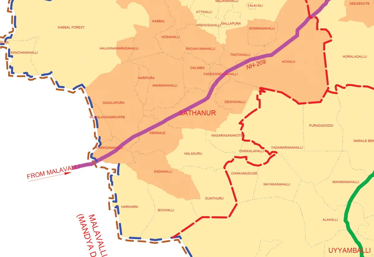

Urban Development In Peri-Urban Bengaluru
Due to population growth and urban development, there were no signs of agriculture in the immediate vicinity, no fields, no post-harvest residue hence there was no evidence of pastoral activity. No herds, no grazing, no doddis at the margins. What might once have functioned as a more permeable landscape, supporting overlapping uses at different times, now operates with a clearer, singular purpose. Access is organised. Movement is channelled. The space is maintained for continuous, predictable use. The question that follows is not only where they have gone, but how such changes are reshaping the pathways available to them?
Urban Development In Peri-Urban Bengaluru
Due to population growth and urban development, there were no signs of agriculture in the immediate vicinity, no fields, no post-harvest residue hence there was no evidence of pastoral activity. No herds, no grazing, no doddis at the margins. What might once have functioned as a more permeable landscape, supporting overlapping uses at different times, now operates with a clearer, singular purpose. Access is organised. Movement is channelled. The space is maintained for continuous, predictable use. The question that follows is not only where they have gone, but how such changes are reshaping the pathways available to them?


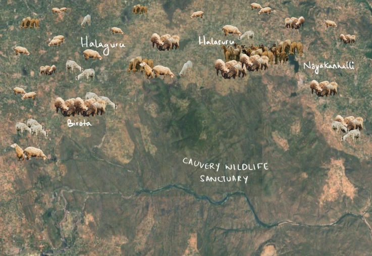
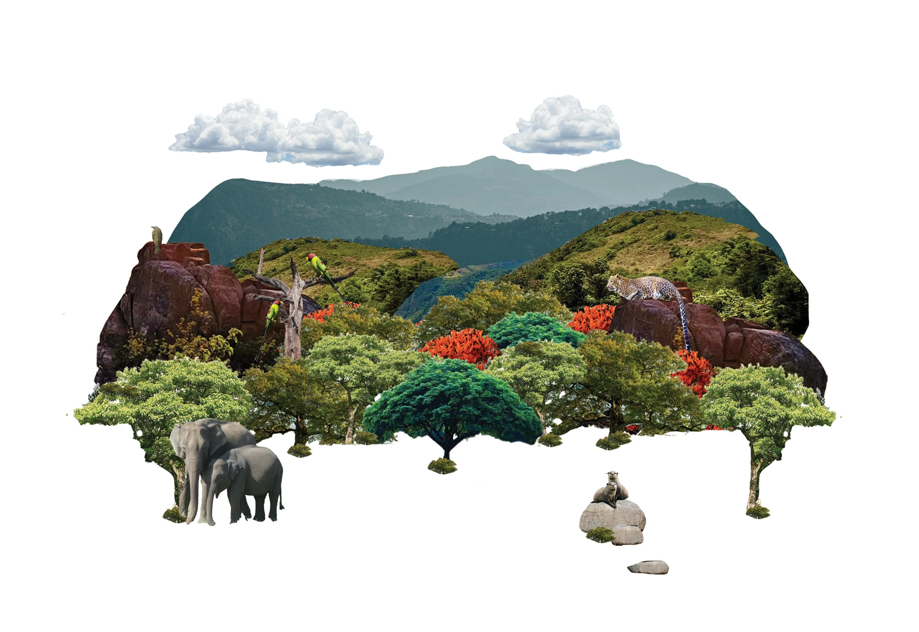
The Kaveri Wildlife Sanctuary stretches over 100 kilometres alongside the Kaveri River in Karnataka. The river cuts through this protected landscape, drawing wildlife, water, and seasonal movement together in a corridor where boundaries between forest, farmland, and river are never quite fixed.
The Confluence of Arkavathi and Kaveri
The first clue came from someone who wasn't even looking for pastoralists. Arun Kumar, a volunteer, had been tracking human-animal conflict across border villages near the Kaveri Wildlife Sanctuary, mapping where elephants crossed into farmland, documenting the tension between wildlife and the people living alongside it.
“Through all of the border villages when I was tracking human-animal conflict, I saw hundreds of sheep grazing in the fields. All throughout villages, hundreds of them. That was my last spotting of such a large herd of sheep,”
The Confluence of Arkavathi and Kaveri
The first clue came from someone who wasn't even looking for pastoralists. Arun Kumar, a volunteer, had been tracking human-animal conflict across border villages near the Kaveri Wildlife Sanctuary, mapping where elephants crossed into farmland, documenting the tension between wildlife and the people living alongside it.
“Through all of the border villages when I was tracking human-animal conflict, I saw hundreds of sheep grazing in the fields. All throughout villages, hundreds of them. That was my last spotting of such a large herd of sheep,”
The Kaveri Wildlife Sanctuary stretches over 100 kilometres alongside the Kaveri River in Karnataka. The river cuts through this protected landscape, drawing wildlife, water, and seasonal movement together in a corridor where boundaries between forest, farmland, and river are never quite fixed.
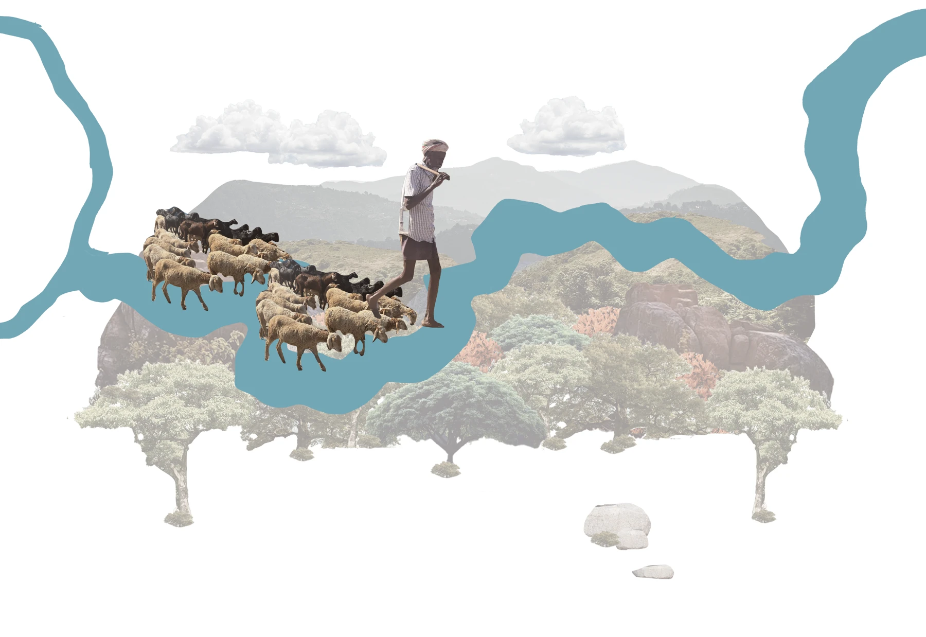
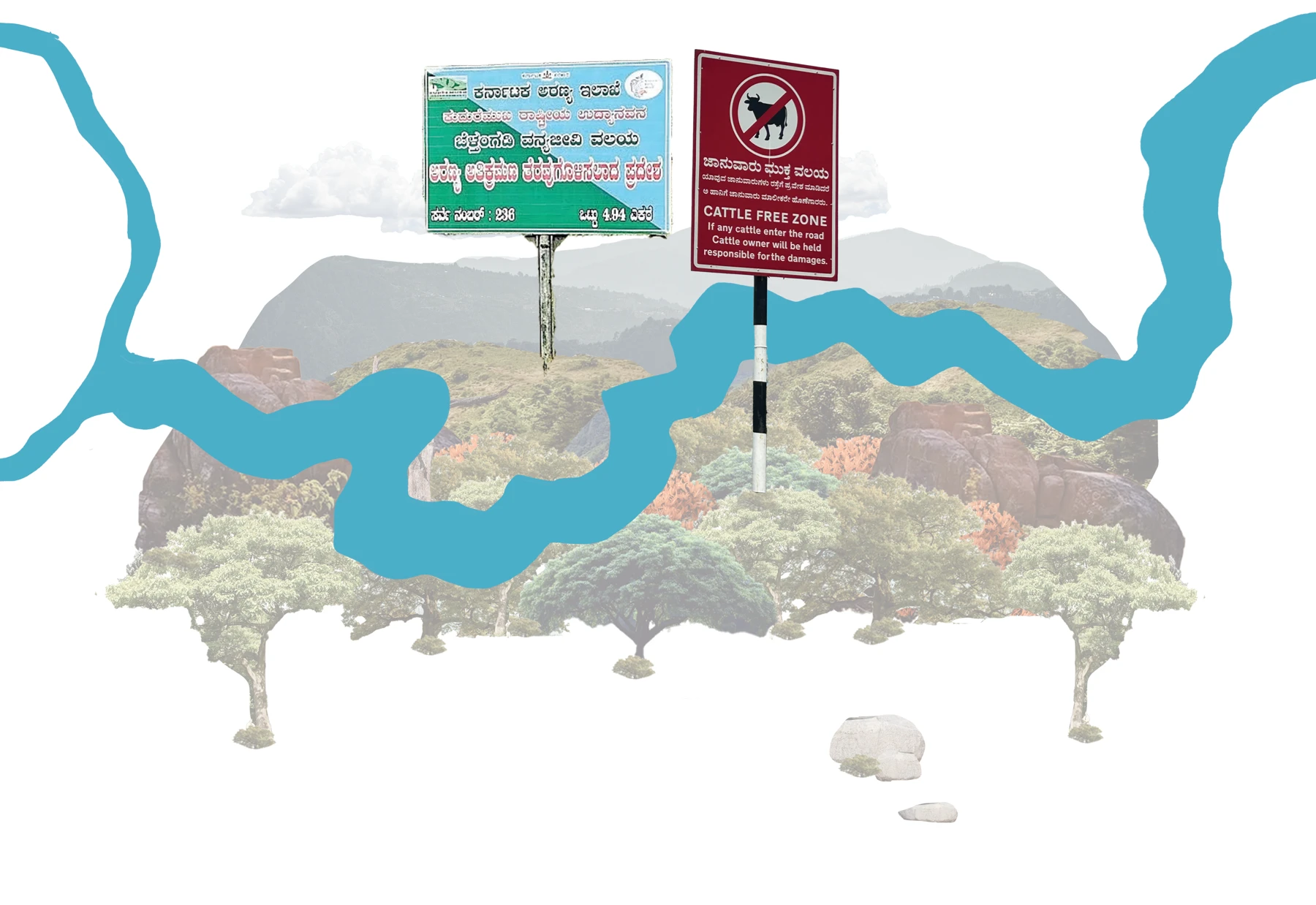


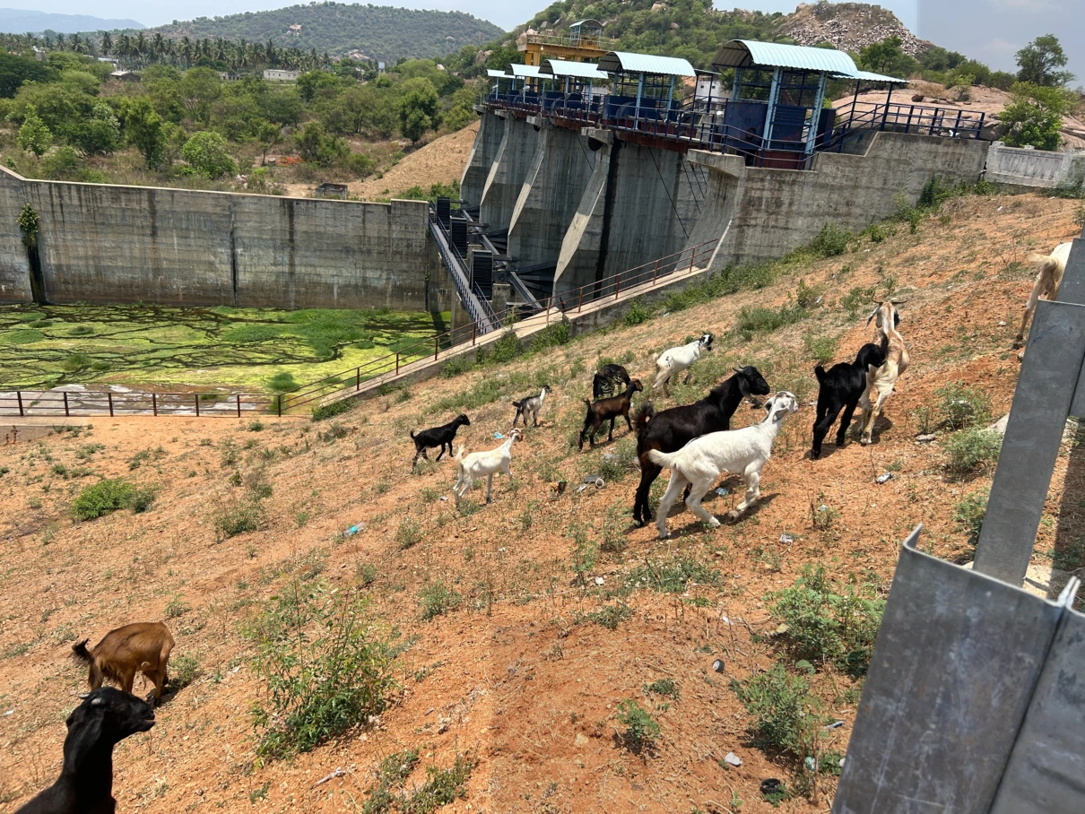
At this dam, they do not need permits from the forest guard to graze, but the narrative shifts on moving further south near Chunchi falls. The pastoralists there require a permit from the forest guards and they usually arrive after lunch and stay till evening with their animals, and must return before dark. Some migratory herds camp on private farms for five to ten days, paying the landowner, grazing, and then moving south. A transactional arrangement, complicated a little by the new farm laws which has changed the land use entirely in the Kanakapura and Ramnagara area.

Damming and Pastoral Access
That is all the animals need and it is becoming harder and harder to find it around the Arkavathi. The dams are the last resort.
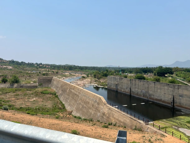
Shepherds these days lead their animals to the dams to graze because there is more water around there, especially for the grass.
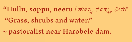
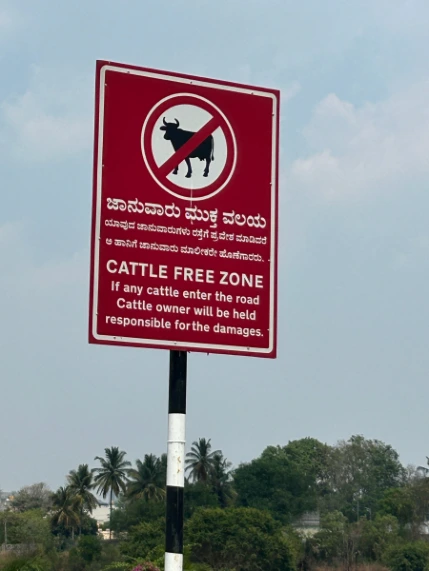
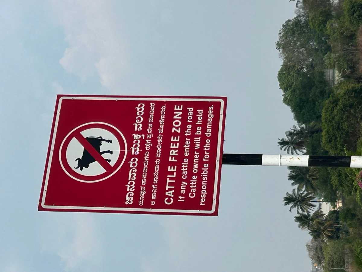
Pastoralists occupy an uneasy position since they are seen as encroachers by the forest department, and as outsiders by the city. Near Nalahalli and Kodihalli where the fields are sown with endless rows of mulberry for silk cultivation, older residents recall when herds of cattle and sheep moved freely through. Now, herds of 30 graze near the Harobele Dam, and they come from Mudammanna doddi.
Damming and Pastoral Access
That is all the animals need and it is becoming harder and harder to find it around the Arkavathi. The dams are the last resort.
Shepherds these days lead their animals to the dams to graze because there is more water around there, especially for the grass.
Pastoralists occupy an uneasy position since they are seen as encroachers by the forest department, and as outsiders by the city. Near Nalahalli and Kodihalli where the fields are sown with endless rows of mulberry for silk cultivation, older residents recall when herds of cattle and sheep moved freely through. Now, herds of 30 graze near the Harobele Dam, and they come from Mudammanna doddi.
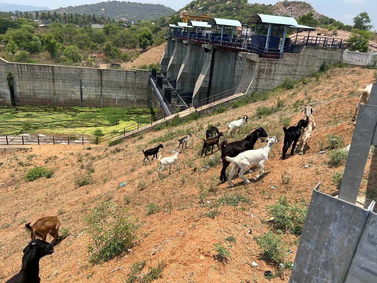
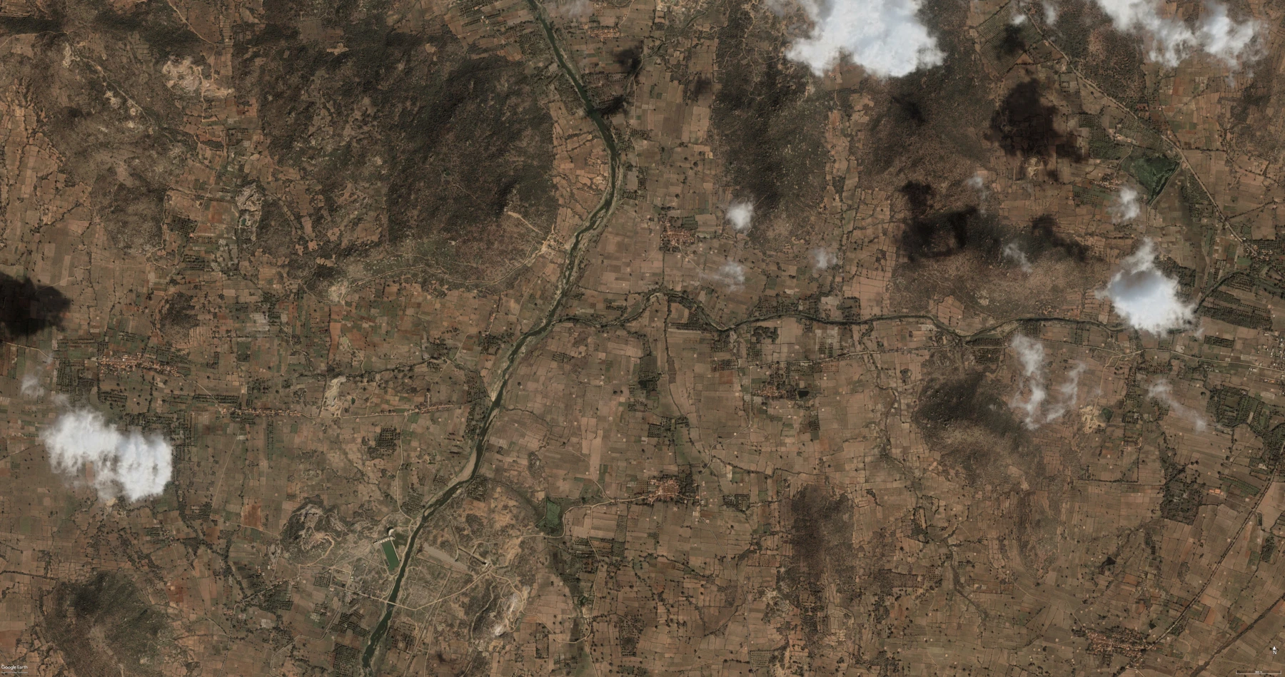
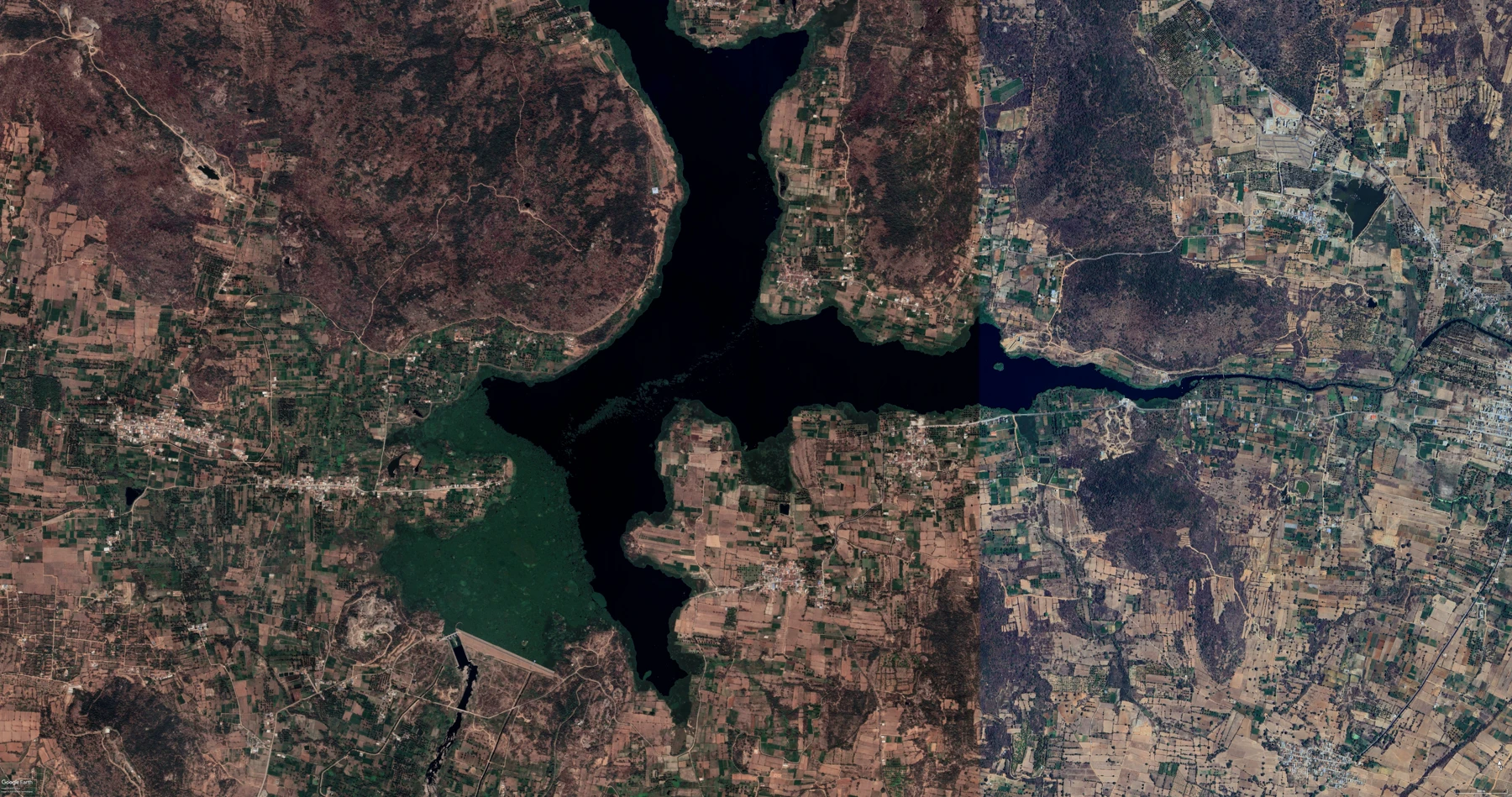

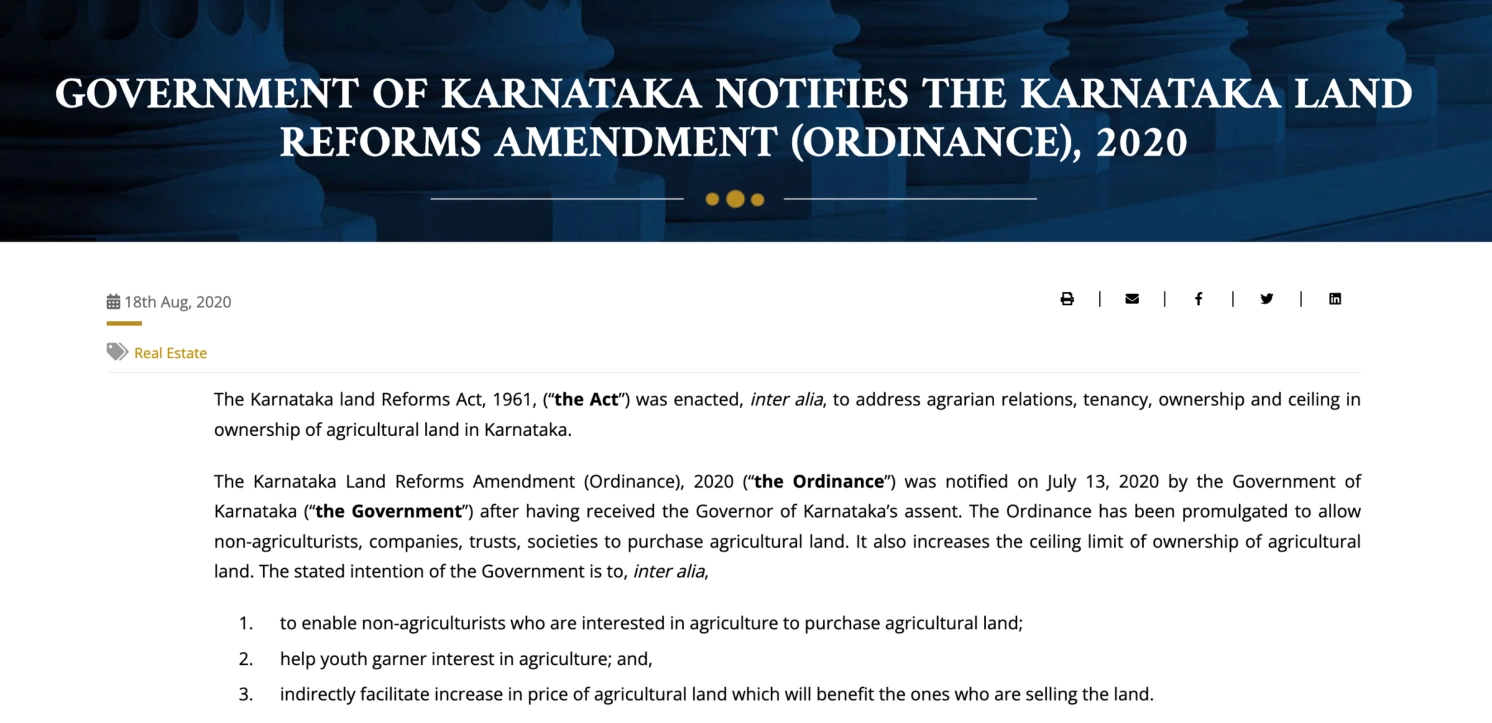
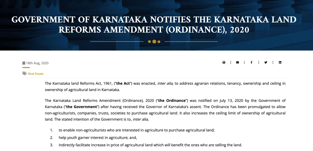
At this dam, they do not need permits from the forest guard to graze, but the narrative shifts on moving further south near Chunchi falls. The pastoralists there require a permit from the forest guards and they usually arrive after lunch and stay till evening with their animals, and must return before dark. Some migratory herds camp on private farms for five to ten days, paying the landowner, grazing, and then moving south. A transactional arrangement, complicated a little by the new farm laws which has changed the land use entirely in the Kanakapura and Ramnagara area.


What can new routes look like?

Pastoralist routes and time don’t follow linear clock time. Similarly, their routes continue to change based on the urbanisation patterns. The land is experienced through the availability of water, rather than measured as rural or urban, or agricultural or wasteland. While the land they have available is reducing every day and being fragmented by new dams, the pastoralists continue to synchronise and adapt based on these new changes. Their journeys weave the complexities of urbanisation, climate change, ecological disruptions, and infrastructure development into an ever-changing, living, entanglement with land and water.
These rhythms and pastoralist time pose a question for all of us: If more-than-human were allowed equal access in our cities, what would their routes look like?
What can new routes look like?
Pastoralist routes and time don’t follow linear clock time. Similarly, their routes continue to change based on the urbanisation patterns. The land is experienced through the availability of water, rather than measured as rural or urban, or agricultural or wasteland. While the land they have available is reducing every day and being fragmented by new dams, the pastoralists continue to synchronise and adapt based on these new changes. Their journeys weave the complexities of urbanisation, climate change, ecological disruptions, and infrastructure development into an ever-changing, living, entanglement with land and water.
These rhythms and pastoralist time pose a question for all of us: If more-than-human were allowed equal access in our cities, what would their routes look like?
Social Relations
Villages play a critical role. They host herders, provide rations or temporary shelter, and sustain long-standing barter relationships. Livestock graze on post-harvest fields, returning nutrients to the soil, while herders receive access and support in exchange.
Pastoralists time their movements around the harvest season, arriving at crop farms to exchange animal manure for income either paid in cash or kind.
This barter system also indicates that long-distance pastoralism is no longer economically self-sufficient. The herders cannot survive solely on what their animals produce or what the landscape provides. They depend on the generosity (or obligation) of the communities they pass through. This raises questions about the long-term viability of the system if economic or social pressures lead villages to stop hosting pastoralists, the entire route collapses.
Villagers: "We have to give them ration and shelter. They will cook their own food."
Physical Pathways
Movement depends on navigable routes, roads, dirt paths, and field edges, that allow large herds to pass without entering private agricultural land or disrupting vehicular traffic. These are not formal corridors, but they are widely understood and used.
Social Relations
Villages play a critical role. They host herders, provide rations or temporary shelter, and sustain long-standing barter relationships. Livestock graze on post-harvest fields, returning nutrients to the soil, while herders receive access and support in exchange.
Pastoralists time their movements around the harvest season, arriving at crop farms to exchange animal manure for income either paid in cash or kind.
Villagers: "We have to give them ration and shelter. They will cook their own food."
This barter system also indicates that long-distance pastoralism is no longer economically self-sufficient. The herders cannot survive solely on what their animals produce or what the landscape provides. They depend on the generosity (or obligation) of the communities they pass through. This raises questions about the long-term viability of the system if economic or social pressures lead villages to stop hosting pastoralists, the entire route collapses.